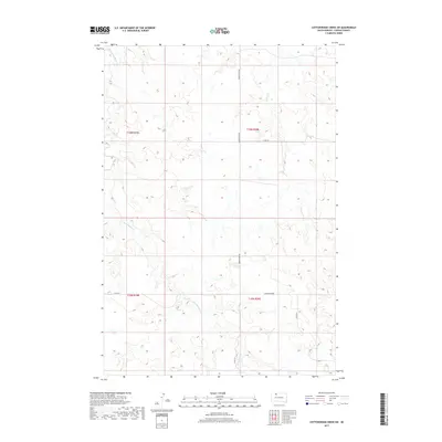
2017 Map of Cottonwood Creek SW
USGS Topo · Published 2017About this map
Archambault Cr and Meadow Cr snake through this section of the Rock Creek District, defining a landscape of high prairie drainage and rural crossroads. The settlement at Gopher Corner serves as a primary reference point in the southeastern quadrant, where Co Rd 315 meets the local transport network. This 2017 survey by the U.S. Geological Survey illustrates the enduring Public Land Survey System grid, with townships like t19n r20e and t18n r19e marking the vast, open tracts of Corson County. Along the northern boundary, Morristown Rd and Black Horse Butte Cr provide further orientation within this sparsely populated ranching and agricultural region.
Find a feature on this map
11 named features on this map. Tap any name to fly to it.
Don’t see what you’re looking for? This feature index may not catch every label — zoom into the map to look around manually.
Map Details
Editions of this 2017 Cottonwood Creek SW Map
This is the sole edition of this map. No revisions or reprints were ever made.
Other maps of this area

1953 · McIntosh
USGS Topo · 1:250,000

1956 · Cottonwood Creek NE
USGS Topo · 1:24,000

1956 · Cottonwood Creek SE
USGS Topo · 1:24,000

1956 · Cottonwood Creek NW
USGS Topo · 1:24,000

1956 · Cottonwood Creek SW
USGS Topo · 1:24,000

1958 · McIntosh
USGS Topo · 1:250,000

1972 · Twin Butte
USGS Topo · 1:24,000

1972 · Black Horse Butte NE
USGS Topo · 1:24,000

1980 · McIntosh
USGS Topo · 1:100,000

1982 · Glad Valley
USGS Topo · 1:24,000