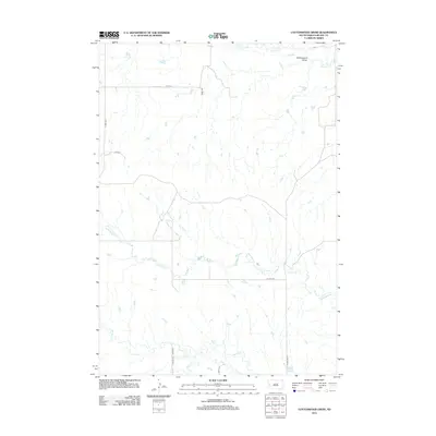
2012 Map of Cottonwood Draw
USGS Topo · Published 2012About this map
Cottonwood Draw and its network of ephemeral watercourses define this rural section of Meade County, characterized by a complex drainage system flowing toward the east. The terrain is deeply marked by the winding paths of Antelope Cr in the south and Alkali Cr in the north, illustrating the erosional patterns common to this part of the South Dakota landscape. Transportation across this open country is facilitated by a grid of rural roads and county highways, including Tilford Rd and Co Hwy Mc-7, which navigate the rises and falls of the draws. The map illustrates a land primarily organized by topography and drainage rather than dense settlement, with routes like Coyote Ln and Galaxy Pl providing access to this interior ranching or grazing territory near the turn of the 21st century.
Find a feature on this map
14 named features on this map. Tap any name to fly to it.
Don’t see what you’re looking for? This feature index may not catch every label — zoom into the map to look around manually.
Map Details
Editions of this 2012 Cottonwood Draw Map
This is the sole edition of this map. No revisions or reprints were ever made.
Other maps of this area

1893 · Rapid
USGS Topo · 1:125,000

1898 · Rapid
USGS Topo · 1:125,000

1903 · Rapid
USGS Topo · 1:125,000

1953 · Bend
USGS Topo · 1:24,000

1953 · Rapid City 1 SW
USGS Topo · 1:24,000

1953 · Rapid City 1 NW
USGS Topo · 1:24,000

1953 · Blackhawk
USGS Topo · 1:24,000

1953 · Rapid City NW
USGS Topo · 1:24,000

1953 · Rapid City 1 NE
USGS Topo · 1:24,000

1953 · Rapid City 1 SE
USGS Topo · 1:24,000