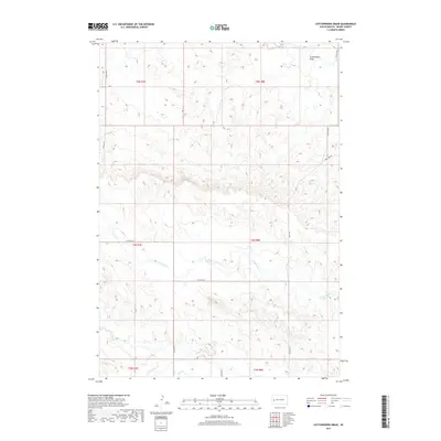
2017 Map of Cottonwood Draw
USGS Topo · Published 2017About this map
Cottonwood Draw and its complex network of seasonal drainage patterns define this landscape in Meade County, where the plains give way to distinct creek beds. The drainage systems of Antelope Cr and Alkali Cr dominate the northern and central sections, illustrating the natural water management of the region before any major modern development. To the south, the terrain descends toward Elk Cr and Morris Cr, areas marked by the transition from rural section lines to isolated residential access roads. This 2017 survey shows a region largely preserved in its agricultural state, with primary access provided by Elk Vale Rd and Co Hwy Mc-8. The survey captures the exact layout of family-named roads and land divisions within Township 4 North, providing a precise record of late-2010s South Dakota land use.
Find a feature on this map
18 named features on this map. Tap any name to fly to it.
Don’t see what you’re looking for? This feature index may not catch every label — zoom into the map to look around manually.
Map Details
Editions of this 2017 Cottonwood Draw Map
This is the sole edition of this map. No revisions or reprints were ever made.
Other maps of this area

1893 · Rapid
USGS Topo · 1:125,000

1898 · Rapid
USGS Topo · 1:125,000

1903 · Rapid
USGS Topo · 1:125,000

1953 · Bend
USGS Topo · 1:24,000

1953 · Rapid City 1 SW
USGS Topo · 1:24,000

1953 · Rapid City 1 NW
USGS Topo · 1:24,000

1953 · Blackhawk
USGS Topo · 1:24,000

1953 · Rapid City NW
USGS Topo · 1:24,000

1953 · Rapid City 1 NE
USGS Topo · 1:24,000

1953 · Rapid City 1 SE
USGS Topo · 1:24,000