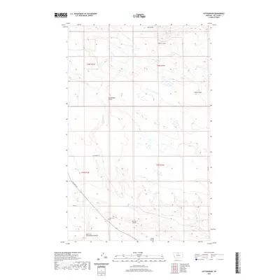
2020 Map of Cottonwood
USGS Topo · Published 2020About this map
Cottonwood Coulee and its numerous drainage systems define this landscape in Hill County, where the high plains are carved by seasonal watercourses. This contemporary survey by the U.S. Geological Survey illustrates a sparsely populated region dominated by vast open sections and the geometric precision of the Public Land Survey System, including t36n r13e and t36n r14e. For genealogists and local historians, the Cottonwood Cem stands as a significant point of interest near the southern junction of Wild Horse Trl. The map traces the winding paths of Redrock Coulee and the East Fork Cottonwood Coulee, revealing the intricate natural irrigation patterns that have influenced land use and travel throughout the county's northern reaches. Primary access is maintained through established routes like Cottonwood Rd, connecting the remote coulees to the broader county infrastructure.
Find a feature on this map
15 named features on this map. Tap any name to fly to it.
Don’t see what you’re looking for? This feature index may not catch every label — zoom into the map to look around manually.
Map Details
Editions of this 2020 Cottonwood Map
This is the sole edition of this map. No revisions or reprints were ever made.
Other maps of this area

1904 · Assinniboine
USGS Topo · 1:62,500

1906 · Kremlin
USGS Topo · 1:62,500

1912 · Thibedeau Lake
USGS Topo · 1:125,000

1920 · Gildford
USGS Topo · 1:125,000

1943 · Gildford
USGS Topo · 1:125,000

1953 · Havre
USGS Topo · 1:250,000

1954 · Shelby
USGS Topo · 1:250,000

1957 · Havre
USGS Topo · 1:250,000

1958 · Shelby
USGS Topo · 1:250,000

1958 · Havre
USGS Topo · 1:250,000