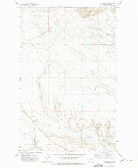
1972 Map of Cottonwood
USGS Topo · Published 1975About this map
Cottonwood Coulee and its tributaries carve a complex drainage pattern across this Hill County landscape, where the high plains of northern Montana meet the legacy of early 20th-century homesteading. The map centers on the small rural community hub defined by the Cottonwood Sch, the Cottonwood Community Hall, and the Cottonwood Cem, providing a detailed record of the social infrastructure that sustained isolated farming families in this region.
Find a feature on this map
11 named features on this map. Tap any name to fly to it.
Don’t see what you’re looking for? This feature index may not catch every label — zoom into the map to look around manually.
Map Details
Editions of this 1972 Cottonwood Map
This is the sole edition of this map. No revisions or reprints were ever made.
Other maps of this area

1904 · Assinniboine
USGS Topo · 1:62,500

1906 · Kremlin
USGS Topo · 1:62,500

1912 · Thibedeau Lake
USGS Topo · 1:125,000

1920 · Gildford
USGS Topo · 1:125,000

1943 · Gildford
USGS Topo · 1:125,000

1953 · Havre
USGS Topo · 1:250,000

1954 · Shelby
USGS Topo · 1:250,000

1957 · Havre
USGS Topo · 1:250,000

1958 · Shelby
USGS Topo · 1:250,000

1958 · Havre
USGS Topo · 1:250,000