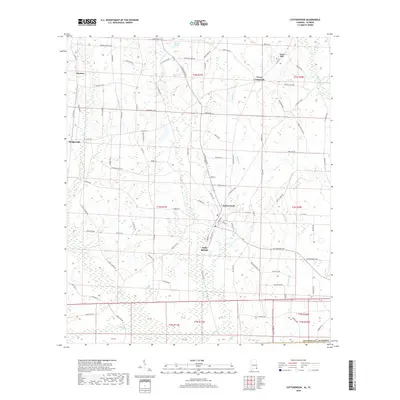
2018 Map of Cottonwood
USGS Topo · Published 2018About this map
Cottonwood and its surroundings in southeast Houston County are defined by a network of rural communities and watercourses near the Florida state line. The landscape is dotted with long-standing local landmarks including New Hope Church and Oak Grove Church, each accompanied by their respective cemeteries, which serve as vital anchor points for genealogical research. The terrain is structured by drainages like Buck Creek and Boggy Creek, which flow toward the southern boundary. Significant clusters of settlement appear at Terry Crossroads and Sealy Springs, while more isolated rises such as Love Hill and Trapper Ridge break the local topography. This late-2010s survey details a region where traditional land divisions meet modern road networks like Cottonwood Road and South County Road 55.
Find a feature on this map
102 named features on this map. Tap any name to fly to it.
Don’t see what you’re looking for? This feature index may not catch every label — zoom into the map to look around manually.
Map Details
Editions of this 2018 Cottonwood Map
This is the sole edition of this map. No revisions or reprints were ever made.
Other maps of this area

1952 · Malone
USGS Topo · 1:24,000

1952 · Campbellton
USGS Topo · 1:24,000

1952 · Sills
USGS Topo · 1:24,000

1953 · Dothan
USGS Topo · 1:250,000

1954 · Dothan
USGS Topo · 1:250,000

1954 · Tallahassee
USGS Topo · 1:250,000

1955 · Dothan
USGS Topo · 1:250,000

1959 · Tallahassee
USGS Topo · 1:250,000

1960 · Tallahassee
USGS Topo · 1:250,000

1969 · Dothan East
USGS Topo · 1:24,000