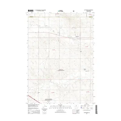
2015 Map of Cottonwood
USGS Topo · Published 2015About this map
Buffalo Gap National Grassland dominates the southern landscape of this West River South Dakota survey, where the prairie is defined by a series of prominent rises and drainage draws. The small settlement of Cottonwood sits at the intersection of Cottonwood Cr and Cottonwood Rd, served by the southern bypass of Highway 14. This area is shaped by a mix of ranching land and protected federal acreage, with the Minuteman Missile National Historic Site anchoring the southwestern corner, reflecting the region's Cold War defense legacy.
Find a feature on this map
38 named features on this map. Tap any name to fly to it.
Don’t see what you’re looking for? This feature index may not catch every label — zoom into the map to look around manually.
Map Details
Editions of this 2015 Cottonwood Map
This is the sole edition of this map. No revisions or reprints were ever made.
Other maps of this area

1953 · Rapid City
USGS Topo · 1:250,000

1954 · Pierre
USGS Topo · 1:250,000

1955 · Hot Springs
USGS Topo · 1:250,000

1955 · Martin
USGS Topo · 1:250,000

1957 · Rapid City
USGS Topo · 1:250,000

1958 · Pierre
USGS Topo · 1:250,000

1958 · Martin
USGS Topo · 1:250,000

1960 · Wall SE
USGS Topo · 1:24,000

1960 · Cottonwood SW
USGS Topo · 1:24,000

1961 · Cottonwood
USGS Topo · 1:24,000