
1961 Map of Cottonwood
USGS Topo · Published 1961About this map
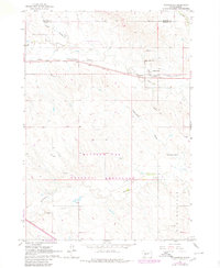
Cottonwood serves as the focal point of this western South Dakota landscape, situated along the Chicago and North Western railroad line. The settlement is supported by essential local landmarks including the Hi-Way Sch and the Cottonwood Cem, providing a window into the community's mid-century rural infrastructure. A nearby Landing Field signifies the importance of small-scale aviation for this remote prairie outpost during the early 1960s.
Find a feature on this map
19 named features on this map. Tap any name to fly to it.
Don’t see what you’re looking for? This feature index may not catch every label — zoom into the map to look around manually.
Map Details
Editions of this 1961 Cottonwood Map
2 editions found
Other maps of this area

1953 · Rapid City
USGS Topo · 1:250,000

1954 · Pierre
USGS Topo · 1:250,000

1955 · Hot Springs
USGS Topo · 1:250,000

1955 · Martin
USGS Topo · 1:250,000

1957 · Rapid City
USGS Topo · 1:250,000

1958 · Pierre
USGS Topo · 1:250,000

1958 · Martin
USGS Topo · 1:250,000

1960 · Wall SE
USGS Topo · 1:24,000

1960 · Cottonwood SW
USGS Topo · 1:24,000

1961 · Cottonwood NE
USGS Topo · 1:24,000