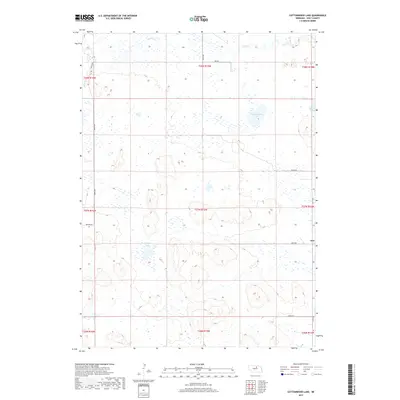
2017 Map of Cottonwood Lake
USGS Topo · Published 2017About this map
Inez is the primary point of settlement on this western Nebraska landscape, situated in the Sandhills region of Holt County. The area is defined by a dense concentration of wetlands and small water bodies, including Cottonwood Lake, Lizard Lake, and Whipple Lake. These natural depressions and intermittent water sources are characteristic of the high-plains terrain where drainage is provided by seasonal flows like Holt Cr. The map reveals a strictly regulated grid of section lines and range boundaries, such as t27n r15w, which dictate the placement of local thoroughfares like 468th Ave and 860th Rd. This 2017 survey by the U.S. Geological Survey documents the sparse, rural character of the region, where isolated homesteads and ranching operations are connected by a network of local connectors and secondary roads.
Find a feature on this map
22 named features on this map. Tap any name to fly to it.
Don’t see what you’re looking for? This feature index may not catch every label — zoom into the map to look around manually.
Map Details
Editions of this 2017 Cottonwood Lake Map
This is the sole edition of this map. No revisions or reprints were ever made.
Other maps of this area

1955 · O'Neill
USGS Topo · 1:250,000

1959 · O'Neill
USGS Topo · 1:250,000

1964 · Emmet NW
USGS Topo · 1:24,000

1964 · Emmet SW
USGS Topo · 1:24,000

1969 · O'Neill
USGS Topo · 1:250,000

1981 · Swan Lake
USGS Topo · 1:24,000

1981 · Amelia
USGS Topo · 1:24,000

1981 · Bruner Lake
USGS Topo · 1:24,000
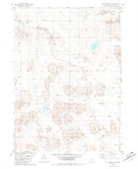
1982 · Cottonwood Lake
USGS Topo · 1:24,000

1982 · Dora Lake
USGS Topo · 1:24,000