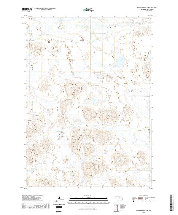
2021 Map of Cottonwood Lake
USGS Topo · Published 2021About this map
The small settlement of Inez sits on the eastern edge of this landscape in Holt County, where the Nebraska Sandhills topography is defined by numerous seasonal wetlands and small basins. The hydrology of the region is centered on features like Whipple Lake and the meandering path of Holt Cr, which drain the undulating terrain. This area remains largely defined by its rural grid, with long stretches of gravel roads such as 468th Ave and 860th Rd providing the primary access to isolated homesteads and grazing lands. The Public Land Survey System markers for t27n r15w and surrounding townships indicate a late-frontier settlement pattern where large-scale ranching and land management predominate over dense town centers.
Find a feature on this map
19 named features on this map. Tap any name to fly to it.
Don’t see what you’re looking for? This feature index may not catch every label — zoom into the map to look around manually.
Map Details
Editions of this 2021 Cottonwood Lake Map
This is the sole edition of this map. No revisions or reprints were ever made.
Other maps of this area

1955 · O'Neill
USGS Topo · 1:250,000

1959 · O'Neill
USGS Topo · 1:250,000

1964 · Emmet NW
USGS Topo · 1:24,000

1964 · Emmet SW
USGS Topo · 1:24,000

1969 · O'Neill
USGS Topo · 1:250,000

1981 · Swan Lake
USGS Topo · 1:24,000

1981 · Amelia
USGS Topo · 1:24,000

1981 · Bruner Lake
USGS Topo · 1:24,000
1982 · Cottonwood Lake
USGS Topo · 1:24,000

1982 · Dora Lake
USGS Topo · 1:24,000