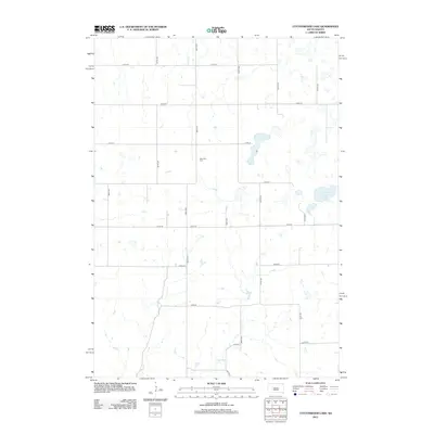
2012 Map of Cottonwood Lake
USGS Topo · Published 2012About this map
New Zion Cem stands as a central landmark in this grid of rural roads and prairie drainage patterns. The landscape is defined by the ephemeral waters of Sand Cr and the larger basin of Cottonwood Lake, reflecting the hydrological character of the northern Great Plains. This 2012 survey documents the section-line road network, including corridors such as 366th Ave and 217th St, which trace the original township and range divisions established during the late 19th-century settlement. The sparse distribution of named features emphasizes the open, agricultural nature of the region, where local history is anchored by family burial grounds and the fluctuating shorelines of prairie lakes.
Find a feature on this map
18 named features on this map. Tap any name to fly to it.
Don’t see what you’re looking for? This feature index may not catch every label — zoom into the map to look around manually.
Map Details
Editions of this 2012 Cottonwood Lake Map
This is the sole edition of this map. No revisions or reprints were ever made.
Other maps of this area

1949 · Vayland SE
USGS Topo · 1:24,000

1949 · Vayland SW
USGS Topo · 1:24,000

1951 · Vayland SW
USGS Topo · 1:24,000

1951 · Wessington SW
USGS Topo · 1:24,000

1951 · Vayland SE
USGS Topo · 1:24,000

1953 · Huron
USGS Topo · 1:250,000

1954 · Huron
USGS Topo · 1:250,000

1973 · Gannvalley
USGS Topo · 1:24,000

1973 · Cottonwood Lake
USGS Topo · 1:24,000

1973 · Wessington Springs NW
USGS Topo · 1:24,000