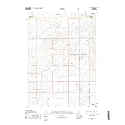
2017 Map of Cottonwood NE
USGS Topo · Published 2017About this map
Buffalo Gap National Grassland dominates the landscape of this western South Dakota region, where the drainage networks of the S Fork Bad River and Cottonwood Cr carve through the high plains. The map reveals a remote, rural geography defined by its draws and creeks, including the distinctive Jackrabbit Draw and Yellow Draw. Local infrastructure is primarily composed of county routes like Fairview Rd and Recluse Rd, which follow the section lines of the Public Land Survey System. The intersection of natural drainage and artificial boundaries is clear where the Jackson Co line meets Haakon Co near the northern reaches of the Dry Cr basin. This survey provides a clear view of the ranching and grassland management patterns that characterize the area south of the Bad River.
Find a feature on this map
30 named features on this map. Tap any name to fly to it.
Don’t see what you’re looking for? This feature index may not catch every label — zoom into the map to look around manually.
Map Details
Editions of this 2017 Cottonwood NE Map
This is the sole edition of this map. No revisions or reprints were ever made.
Other maps of this area

1950 · Weta
USGS Topo · 1:24,000

1953 · Philip Junction
USGS Topo · 1:24,000

1953 · Philip
USGS Topo · 1:24,000

1954 · Pierre
USGS Topo · 1:250,000

1955 · Martin
USGS Topo · 1:250,000

1958 · Pierre
USGS Topo · 1:250,000

1958 · Martin
USGS Topo · 1:250,000

1960 · Cottonwood SW
USGS Topo · 1:24,000

1961 · Cottonwood
USGS Topo · 1:24,000

1961 · Cottonwood NE
USGS Topo · 1:24,000