
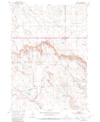
1950 Map of Weta
USGS Topo · Published 1952About this map
The Chicago Milwaukee St Paul and Pacific railroad bisects this 1950 South Dakota landscape, providing a vital transport corridor through Jackson County. The small settlement of Weta sits along the rail line, representing the essential rural rail-and-ranching hubs of the era. To the north, the terrain transitions into the broken bluffs and draws characterized by Chamberlain Pass and Hughes Pass, where elevation changes mark the divide between drainage basins. The map captures the agricultural and transportation footprint of the mid-century, including the Peterson Ranch and a local Landing Field near Sevenmile Corner. These features, along with the winding courses of Little Buffalo Creek and Fifteenmile Creek, illustrate a period when the development of the Missouri River Basin was shaping the infrastructure and land use of the High Plains.
Find a feature on this map
13 named features on this map. Tap any name to fly to it.
Don’t see what you’re looking for? This feature index may not catch every label — zoom into the map to look around manually.
Map Details
Editions of this 1950 Weta Map
2 editions found
Other maps of this area

1951 · Wanblee NW
USGS Topo · 1:24,000

1951 · School Section Butte
USGS Topo · 1:24,000

1951 · Kadoka
USGS Topo · 1:24,000

1951 · Wanblee NE
USGS Topo · 1:24,000

1953 · Philip Junction
USGS Topo · 1:24,000

1954 · Kadoka NE
USGS Topo · 1:24,000

1955 · Martin
USGS Topo · 1:250,000

1958 · Martin
USGS Topo · 1:250,000

1961 · Cottonwood NE
USGS Topo · 1:24,000
1961 · Cottonwood SE
USGS Topo · 1:24,000