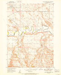
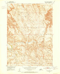
1951 Map of School Section Butte
USGS Topo · Published 1951About this map
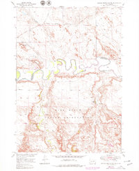
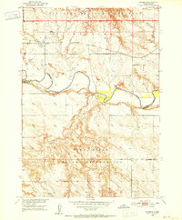
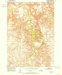
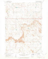
The White River meanders sharply through the heart of this territory, forming a natural boundary between several distinct landscape management areas during the early 1950s. To the south lies the northern expanse of the Pine Ridge Indian Reservation, where Bear-in-the-lodge Creek and Eagle Nest Creek flow toward the river valley. The topography is defined by significant elevations such as School Section Butte and Flat Top Butte, which overlook a network of seasonal drainage's including Sixteenmile Creek and Rake Creek.
Find a feature on this map
18 named features on this map. Tap any name to fly to it.
Don’t see what you’re looking for? This feature index may not catch every label — zoom into the map to look around manually.
Map Details
Editions of this 1951 School Section Butte Map
2 editions found
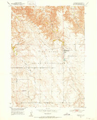
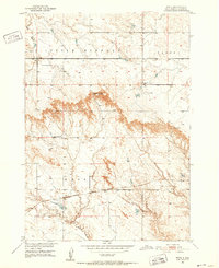
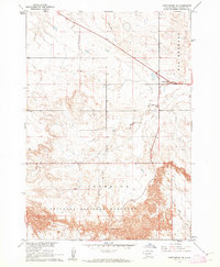
Other maps of this area
1950 · Interior
USGS Topo · 1:24,000
1950 · Interior SE
USGS Topo · 1:24,000
1950 · Potato Creek
USGS Topo · 1:24,000
1950 · Wanblee
USGS Topo · 1:24,000
1950 · Weta
USGS Topo · 1:24,000

1951 · Wanblee NW
USGS Topo · 1:24,000

1955 · Martin
USGS Topo · 1:250,000

1958 · Martin
USGS Topo · 1:250,000
1960 · Cottonwood SW
USGS Topo · 1:24,000
1961 · Cottonwood SE
USGS Topo · 1:24,000