1950 Map of Interior SE
USGS Topo · Published 1952About this map
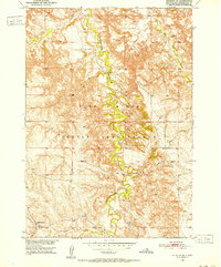
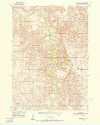
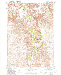
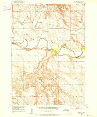
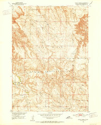
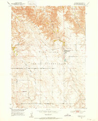
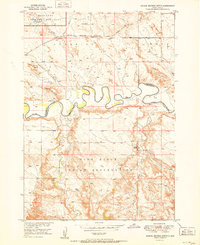
Pine Ridge Indian Reservation terrain dominates this 1950 survey, showcasing the complex drainage systems of the South Dakota badlands. The winding course of Bear-in-the-Lodge Creek carves through the center of the sheet, joined by Eagle Nest Creek and Turtle Creek as they navigate the deeply dissected landscape. These waterways dictate the sparse human footprint, where early cattle ranching and rural education formed the backbone of the local community. Evidence of this modest infrastructure is found at the Headlee Ranch and the remote Garner Sch. This map was produced as part of the Department of the Interior program for the development of the Missouri River Basin, capturing the geography of Washabaugh and Jackson counties before later administrative changes reorganized the region.
Find a feature on this map
6 named features on this map. Tap any name to fly to it.
Don’t see what you’re looking for? This feature index may not catch every label — zoom into the map to look around manually.
Map Details
Editions of this 1950 Interior SE Map
3 editions found
Other maps of this area
1950 · Interior
USGS Topo · 1:24,000
1950 · Potato Creek
USGS Topo · 1:24,000
1950 · Wanblee
USGS Topo · 1:24,000

1951 · Wanblee NW
USGS Topo · 1:24,000
1951 · School Section Butte
USGS Topo · 1:24,000

1955 · Martin
USGS Topo · 1:250,000

1958 · Martin
USGS Topo · 1:250,000

1980 · Kadoka
USGS Topo · 1:100,000

1981 · Hisle
USGS Topo · 1:25,000

1981 · Buzzard Butte
USGS Topo · 1:25,000