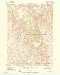
1950 Map of Interior SE
USGS Topo · Published 1952About this map
Pine Ridge Indian Reservation lands dominate this mid-century landscape, centered on the winding course of Bear-in-the-Lodge Creek. Surveyed in 1950, the map documents the sparse infrastructure of Jackson County at a time when the region was being studied for the Missouri River Basin development program. The terrain is marked by intricate drainage patterns feeding into the creek from the surrounding high ground, with Eagle Nest Creek and Turtle Creek cutting through the prairie in the northeast and southwest respectively.
Find a feature on this map
7 named features on this map. Tap any name to fly to it.
Don’t see what you’re looking for? This feature index may not catch every label — zoom into the map to look around manually.
Map Details
Editions of this 1950 Interior SE Map
3 editions found
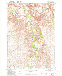
Other maps of this area

1950 · Interior
USGS Topo · 1:24,000

1950 · Interior SE
USGS Topo · 1:24,000

1950 · Potato Creek
USGS Topo · 1:24,000

1950 · Wanblee
USGS Topo · 1:24,000

1951 · Wanblee NW
USGS Topo · 1:24,000

1951 · School Section Butte
USGS Topo · 1:24,000

1955 · Martin
USGS Topo · 1:250,000

1958 · Martin
USGS Topo · 1:250,000

1980 · Kadoka
USGS Topo · 1:100,000

1981 · Hisle
USGS Topo · 1:25,000