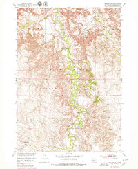
1950 Map of Interior SE
USGS Topo · Published 1979About this map
Pine Ridge Indian Reservation land defines this mid-century landscape, characterized by the deeply winding course of Bear-in-the-Lodge Creek. This waterway carves a distinct, narrow valley through the high plains, providing a vital riparian corridor in an otherwise arid topography. Settlement patterns are sparse, represented by isolated landmarks such as the Headlee Ranch and the Garner Sch, reflecting the cattle-ranching economy and rural infrastructure of the period. The drainage network is further documented by Eagle Nest Creek and Turtle Creek, which feed into the primary basin. This survey, based on 1948 photography and updated with 1970s aerial data, captures the intersection of indigenous reservation boundaries and the expansive Missouri River Basin development program.
Find a feature on this map
9 named features on this map. Tap any name to fly to it.
Don’t see what you’re looking for? This feature index may not catch every label — zoom into the map to look around manually.
Map Details
Editions of this 1950 Interior SE Map
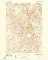
3 editions found
Other maps of this area

1950 · Interior
USGS Topo · 1:24,000

1950 · Interior SE
USGS Topo · 1:24,000

1950 · Potato Creek
USGS Topo · 1:24,000

1950 · Wanblee
USGS Topo · 1:24,000

1951 · Wanblee NW
USGS Topo · 1:24,000

1951 · School Section Butte
USGS Topo · 1:24,000

1955 · Martin
USGS Topo · 1:250,000

1958 · Martin
USGS Topo · 1:250,000

1980 · Kadoka
USGS Topo · 1:100,000

1981 · Hisle
USGS Topo · 1:25,000