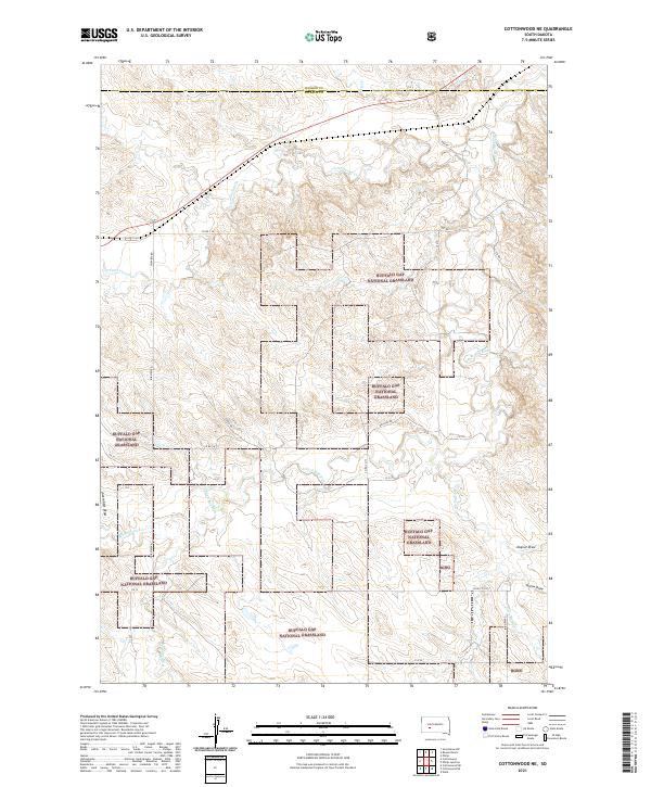
2021 Map of Cottonwood NE
USGS Topo · Published 2021About this map
The Buffalo Gap National Grassland dominates this corner of Jackson County, showcasing the sprawling rangeland character of western South Dakota. The drainage patterns of the S Fork Bad River and its tributaries, including Cottonwood Cr and Little Buffalo Cr, dictate the movement across this open landscape. The topography is defined by significant draws and intermittent streams such as Jackrabbit Draw and Whitewater Cr, which carve through the high plains.
Find a feature on this map
31 named features on this map. Tap any name to fly to it.
Don’t see what you’re looking for? This feature index may not catch every label — zoom into the map to look around manually.
Map Details
Editions of this 2021 Cottonwood NE Map
This is the sole edition of this map. No revisions or reprints were ever made.
Other maps of this area

1950 · Weta
USGS Topo · 1:24,000

1953 · Philip Junction
USGS Topo · 1:24,000

1953 · Philip
USGS Topo · 1:24,000

1954 · Pierre
USGS Topo · 1:250,000

1955 · Martin
USGS Topo · 1:250,000

1958 · Pierre
USGS Topo · 1:250,000

1958 · Martin
USGS Topo · 1:250,000

1960 · Cottonwood SW
USGS Topo · 1:24,000

1961 · Cottonwood
USGS Topo · 1:24,000

1961 · Cottonwood NE
USGS Topo · 1:24,000