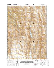
2014 Map of Cottonwood Reservoir
USGS Topo · Published 2014About this map
Cottonwood Reservoir serves as a focal point for water management in this arid stretch of Harney County, situated just south of the Malhuer National Forest boundary. The landscape is defined by its complex drainage network, where Cottonwood Cr and Squaw Cr are captured by the Squaw Cr Reservoir and the Altnow Ditch. This infrastructure highlights the historical necessity of irrigation and livestock watering in a high-desert environment. Further south, the terrain opens into the Otis Valley and the Beede Desert, illustrating the transition from timbered forest edges to open range. Essential water sources for early ranching operations are scattered across the sheet, including Antelope Spring, Dipping Vat Spring, and Jackson Spring. Remote travel is documented by the Otis Valley Rd and Crane-Prairie-Drewsey Rd, which follow the natural contours of the land through areas like Rocky Basin and Mill Gulch.
Find a feature on this map
23 named features on this map. Tap any name to fly to it.
Don’t see what you’re looking for? This feature index may not catch every label — zoom into the map to look around manually.
Map Details
Editions of this 2014 Cottonwood Reservoir Map
This is the sole edition of this map. No revisions or reprints were ever made.
Other maps of this area

1908 · Ironside Mountain
USGS Topo · 1:125,000

1955 · Burns
USGS Topo · 1:250,000

1955 · Canyon City
USGS Topo · 1:250,000

1958 · Burns
USGS Topo · 1:250,000

1959 · Burns
USGS Topo · 1:250,000

1959 · Canyon City
USGS Topo · 1:250,000

1966 · Beulah
USGS Topo · 1:62,500

1968 · Drewsey
USGS Topo · 1:62,500

1970 · Flag Prairie
USGS Topo · 1:62,500

1970 · Castle Rock
USGS Topo · 1:62,500