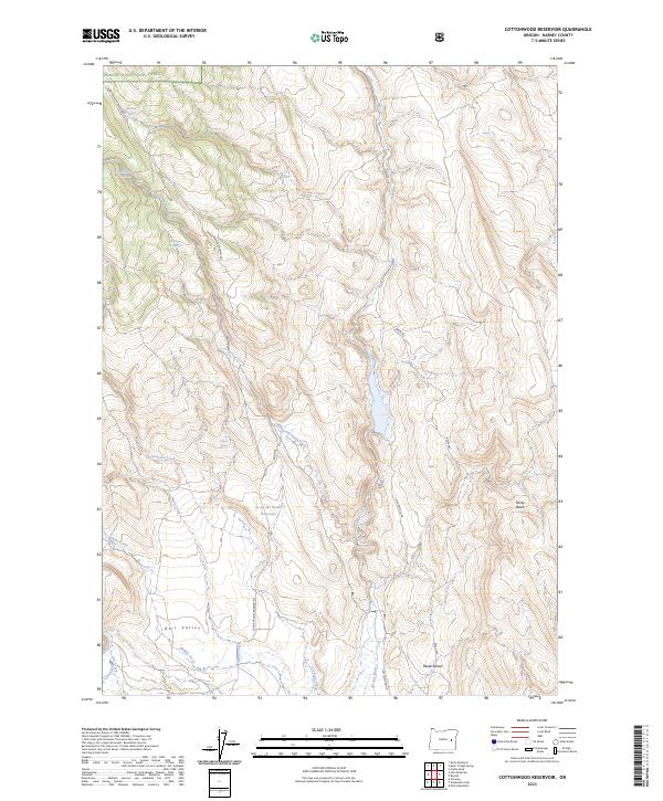
2023 Map of Cottonwood Reservoir
USGS Topo · Published 2023About this map
Malheur National Forest dominates the northern landscape of this Harney County terrain, giving way to the southern expanses of Otis Valley and the Beede Desert. The map reveals an intricate network of water management and natural drainage, centered on the Se-ng-abi Huudi Reservoir and the Altnow Ditch. These features imply a history of high-desert ranching and water rights management, where seasonal flows from Se-ng-abi Huudi Creek and Cottonwood Creek were critical for sustaining livestock and marginal agriculture. Local landmarks like Jackson Spring, Antelope Spring, and Dipping Vat Spring highlight the essential nature of reliable water sources for early settlers and forest rangers. The rugged transition from the timbered uplands into Rocky Basin is navigated by the Crane-Prairie Drewsey Rd, a key corridor for movement through this sparsely populated interior.
Find a feature on this map
22 named features on this map. Tap any name to fly to it.
Don’t see what you’re looking for? This feature index may not catch every label — zoom into the map to look around manually.
Map Details
Editions of this 2023 Cottonwood Reservoir Map
This is the sole edition of this map. No revisions or reprints were ever made.
Other maps of this area

1908 · Ironside Mountain
USGS Topo · 1:125,000

1955 · Burns
USGS Topo · 1:250,000

1955 · Canyon City
USGS Topo · 1:250,000

1958 · Burns
USGS Topo · 1:250,000

1959 · Burns
USGS Topo · 1:250,000

1959 · Canyon City
USGS Topo · 1:250,000

1966 · Beulah
USGS Topo · 1:62,500

1968 · Drewsey
USGS Topo · 1:62,500

1970 · Flag Prairie
USGS Topo · 1:62,500

1970 · Castle Rock
USGS Topo · 1:62,500