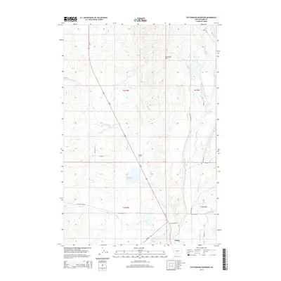
2014 Map of Cottonwood Reservoir
USGS Topo · Published 2014About this map
Cottonwood Reservoir serves as a central hydrological landmark in this Park County landscape, which is defined by a sophisticated system of irrigation and natural waterways. The southern reaches of the map show the settlement of Wilsall and the Wilsall Airport situated near the confluence of Flathead Cr and the Shields River. This area reveals the essential connection between the region's agricultural economy and its water management, visible through features like the Big Canal and Myers Ditch that draw from the river system.
Find a feature on this map
36 named features on this map. Tap any name to fly to it.
Don’t see what you’re looking for? This feature index may not catch every label — zoom into the map to look around manually.
Map Details
Editions of this 2014 Cottonwood Reservoir Map
This is the sole edition of this map. No revisions or reprints were ever made.
Other maps of this area

1886 · Little Belt Mts.
USGS Topo · 1:250,000

1891 · Livingston
USGS Topo · 1:250,000

1893 · Livingston
USGS Topo · 1:250,000

1894 · Little Belt Mts.
USGS Topo · 1:250,000

1897 · Little Belt Mts.
USGS Topo · 1:250,000

1898 · Little Belt Mts.
USGS Topo · 1:250,000

1902 · Little Belt Mts.
USGS Topo · 1:250,000

1947 · Bozeman
USGS Topo · 1:250,000

1948 · Bozeman
USGS Topo · 1:250,000

1948 · White Sulphur Springs
USGS Topo · 1:250,000