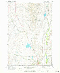
1972 Map of Cottonwood Reservoir
USGS Topo · Published 1975About this map
The Shields River valley in Park County defines this western landscape, where a sophisticated network of irrigation infrastructure supports the regional ranching economy. Water management is the primary human imprint on the terrain, anchored by the Cottonwood Reservoir and its associated Spillway 5100. A complex system of diversions including the Big Canal and the Shields Myers Ditch moves water across the flats toward the Flathead settlement area.
Find a feature on this map
28 named features on this map. Tap any name to fly to it.
Don’t see what you’re looking for? This feature index may not catch every label — zoom into the map to look around manually.
Map Details
Editions of this 1972 Cottonwood Reservoir Map
This is the sole edition of this map. No revisions or reprints were ever made.
Other maps of this area

1886 · Little Belt Mts.
USGS Topo · 1:250,000

1891 · Livingston
USGS Topo · 1:250,000

1893 · Livingston
USGS Topo · 1:250,000

1894 · Little Belt Mts.
USGS Topo · 1:250,000

1897 · Little Belt Mts.
USGS Topo · 1:250,000

1898 · Little Belt Mts.
USGS Topo · 1:250,000

1902 · Little Belt Mts.
USGS Topo · 1:250,000

1947 · Bozeman
USGS Topo · 1:250,000

1948 · Bozeman
USGS Topo · 1:250,000

1948 · White Sulphur Springs
USGS Topo · 1:250,000