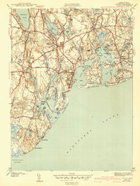
1943 Map of Cotuit
USGS Topo · Published 1943About this map
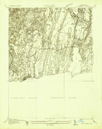
Mashpee and the village of Cotuit define this coastal landscape at the start of the 1940s, where the intricate shoreline of Nantucket Sound meets a network of freshwater kettle ponds. The boundary between Mashpee and Barnstable runs through the center of the sheet, separating the residential clusters of Marstons Mills and Osterville from the more open lands to the west. This era shows the developed estates of Grand Island Oyster Harbors and the waterfront community at Wianno, indicating the area's established role as a summer destination. Inland, the importance of local recreation and community is evident at the Santuit Golf Course and Camp Cotuit. Transportation is anchored by the crossing at Pine Tree Corner and the winding Sandwich Road, connecting the interior ponds like Santuit Pond and Mashpee Pond to the saltwater bays of Popponesset Bay and Cotuit Bay.
Find a feature on this map
81 named features on this map. Tap any name to fly to it.
Don’t see what you’re looking for? This feature index may not catch every label — zoom into the map to look around manually.
Map Details
Editions of this 1943 Cotuit Map
3 editions found
Other maps of this area

1886 · Falmouth
USGS Topo · 1:62,500

1888 · Barnstable
USGS Topo · 1:62,500

1888 · Falmouth
USGS Topo · 1:62,500

1893 · Barnstable
USGS Topo · 1:62,500

1893 · Falmouth
USGS Topo · 1:62,500

1915 · Falmouth
USGS Topo · 1:62,500

1920 · Falmouth
USGS Topo · 1:62,500
1935 · Pocasset
USGS Topo · 1:20,000
1936 · Falmouth
USGS Topo · 1:25,000

1938 · Sandwich
USGS Topo · 1:31,680