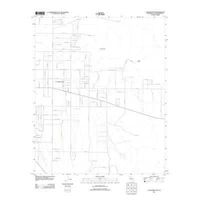
2012 Map of Cougar Buttes
USGS Topo · Published 2012About this map
Lucerne Valley serves as the central hub of this Mojave Desert landscape, characterized by a grid of residential and agricultural roads that give way to the prominent elevations of Cougar Buttes and Negro Butte. The map reveals a fascinating celestial-themed naming convention for the local street network, where roads like Saturn Rd, Big Dipper Dr, and Stellar Rd intersect with established thoroughfares such as Powerline Rd. This development pattern highlights the mid-century to modern growth of this high-desert community, balancing the reach of modern utilities and neighborhood planning against the isolation of the surrounding desert terrain. Long-distance routes like Cherokee Trl and Rabbit Springs Rd connect the settlement to the broader San Bernardino County geography, marking the transition from suburban outskirts to the open flats of the Lucerne dry lake region.
Find a feature on this map
88 named features on this map. Tap any name to fly to it.
Don’t see what you’re looking for? This feature index may not catch every label — zoom into the map to look around manually.
Map Details
Editions of this 2012 Cougar Buttes Map
This is the sole edition of this map. No revisions or reprints were ever made.
Other maps of this area

1901 · Southern California Sheet No. 1
USGS Topo · 1:250,000

1902 · San Gorgonio
USGS Topo · 1:125,000

1904 · Southern California Sheet No. 1
USGS Topo · 1:250,000

1947 · Lucerne Valley
USGS Topo · 1:62,500

1949 · Lucerne Valley
USGS Topo · 1:62,500

1953 · San Bernardino
USGS Topo · 1:250,000

1955 · Old Woman Springs
USGS Topo · 1:62,500

1955 · Ord Mountains
USGS Topo · 1:62,500

1955 · Rodman Mountains
USGS Topo · 1:62,500

1956 · San Bernardino
USGS Topo · 1:250,000