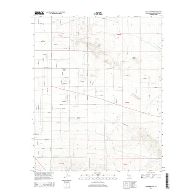
2015 Map of Cougar Buttes
USGS Topo · Published 2015About this map
Lucerne Valley sits at the heart of this high-desert landscape, where the flat expanse of the Mojave Desert meets distinct geological formations. The area is defined by the prominent Cougar Buttes and Negro Butte, which rise sharply above the surrounding basin. A celestial-themed residential grid marks the northern portion of the settlement, with streets named Meteor Way, Stellar Rd, Saturn RD, and Planet Rd branching off from Wilshire Rd. This celestial nomenclature reflects the mid-century aerospace influence and suburban aspirations common in desert communities. Beyond the residential clusters, the landscape is crisscrossed by utility corridors like Power Line Rd and significant thoroughfares including Camp Rock Rd and Rabbit Springs Rd, while the historic Cherokee Trl skirts the western edge, providing a connection to the region's earlier travel routes.
Find a feature on this map
85 named features on this map. Tap any name to fly to it.
Don’t see what you’re looking for? This feature index may not catch every label — zoom into the map to look around manually.
Map Details
Editions of this 2015 Cougar Buttes Map
This is the sole edition of this map. No revisions or reprints were ever made.
Other maps of this area

1901 · Southern California Sheet No. 1
USGS Topo · 1:250,000

1902 · San Gorgonio
USGS Topo · 1:125,000

1904 · Southern California Sheet No. 1
USGS Topo · 1:250,000

1947 · Lucerne Valley
USGS Topo · 1:62,500

1949 · Lucerne Valley
USGS Topo · 1:62,500

1953 · San Bernardino
USGS Topo · 1:250,000

1955 · Old Woman Springs
USGS Topo · 1:62,500

1955 · Ord Mountains
USGS Topo · 1:62,500

1955 · Rodman Mountains
USGS Topo · 1:62,500

1956 · San Bernardino
USGS Topo · 1:250,000