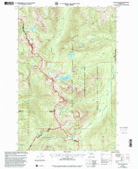
2000 Map of Cougar Lake
USGS Topo · Published 2001About this map
Pacific Crest National Scenic Trail traverses the high ridges along the county lines of Yakima, Pierce, and Lewis, marking a corridor between major wilderness areas at the turn of the 21st century. The landscape is defined by its complex hydrology, with the Bumping River and American River draining a series of alpine basins. High-altitude landmarks like Crag Mountain overlook a network of lakes including Cougar Lake, Dewey Lake, and the cluster at Three Lakes. This survey shows the region as a point of convergence for protected lands, including the eastern reaches of Mount Rainier National Park and the William O Douglas Wilderness. Evidence of backcountry management is seen at the Patrol Cabin, reflecting the area's continued use for recreation and forest service oversight.
Find a feature on this map
53 named features on this map. Tap any name to fly to it.
Don’t see what you’re looking for? This feature index may not catch every label — zoom into the map to look around manually.
Map Details
Editions of this 2000 Cougar Lake Map
This is the sole edition of this map. No revisions or reprints were ever made.
Other maps of this area

1902 · Mount Aix
USGS Topo · 1:125,000

1904 · Mt Aix
USGS Topo · 1:125,000

1924 · Mt Rainier
USGS Topo · 1:96,000

1928 · Mt Rainier
USGS Topo · 1:125,000

1950 · Yakima
USGS Topo · 1:250,000

1958 · Yakima
USGS Topo · 1:250,000

1961 · Yakima
USGS Topo · 1:250,000

1962 · Bumping Lake
USGS Topo · 1:62,500

1962 · White Pass
USGS Topo · 1:62,500

1962 · Packwood
USGS Topo · 1:62,500