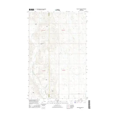
2017 Map of Coulter Coulee
USGS Topo · Published 2017About this map
Frenchman Creek carves a winding path through this corner of North-Central Montana, defining a landscape marked by complex drainage patterns and seasonal water catchments. The terrain is characterized by a series of deep coulees, including Coulter Coulee, Red Mud Coulee, and School Section Coulee, which channel runoff across the high plains. Human presence is evidenced by isolated water management features such as Morgan Reservoir and Coral Reservoir, essential for ranching and land use in this arid environment.
Find a feature on this map
22 named features on this map. Tap any name to fly to it.
Don’t see what you’re looking for? This feature index may not catch every label — zoom into the map to look around manually.
Map Details
Editions of this 2017 Coulter Coulee Map
This is the sole edition of this map. No revisions or reprints were ever made.
Other maps of this area

1954 · Glasgow
USGS Topo · 1:250,000

1957 · Glasgow
USGS Topo · 1:250,000

1958 · Glasgow
USGS Topo · 1:250,000

1984 · Thoeny Hills East
USGS Topo · 1:24,000

1984 · Snake Creek School
USGS Topo · 1:24,000

1984 · Black Calf Reservoir
USGS Topo · 1:24,000

1984 · Coulter Coulee
USGS Topo · 1:24,000

1984 · Dead Horse Coulee
USGS Topo · 1:24,000

1984 · Crow Creek Dam
USGS Topo · 1:24,000
1984 · Papoose Hills
USGS Topo · 1:24,000