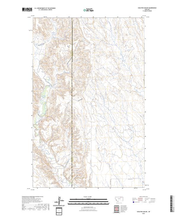
2024 Map of Coulter Coulee
USGS Topo · Published 2024About this map
Frenchman Creek meanders through this portion of the northern Montana plains, defining a landscape shaped by seasonal water management and the rugged drainage systems of the Missouri River basin. The map reveals a sparse network of ranching roads, including Frenchman Rd and Upper Frenchman Rd, which navigate the complex topography of unnamed breaks and high flats. Significant water storage is represented by Morgan Reservoir and Carol Reservoir, critical infrastructure in this arid environment. Distinctive local landmarks like Big Toe Flat and the deep incisions of Red Mud Coulee and Shed Coulee illustrate the erosive power of the elements in Valley County. The transition across the Phillips County and Valley County line highlights the administrative boundaries of this vast grazing territory.
Find a feature on this map
20 named features on this map. Tap any name to fly to it.
Don’t see what you’re looking for? This feature index may not catch every label — zoom into the map to look around manually.
Map Details
Editions of this 2024 Coulter Coulee Map
This is the sole edition of this map. No revisions or reprints were ever made.
Other maps of this area

1954 · Glasgow
USGS Topo · 1:250,000

1957 · Glasgow
USGS Topo · 1:250,000

1958 · Glasgow
USGS Topo · 1:250,000

1984 · Thoeny Hills East
USGS Topo · 1:24,000

1984 · Snake Creek School
USGS Topo · 1:24,000

1984 · Black Calf Reservoir
USGS Topo · 1:24,000

1984 · Coulter Coulee
USGS Topo · 1:24,000

1984 · Dead Horse Coulee
USGS Topo · 1:24,000

1984 · Crow Creek Dam
USGS Topo · 1:24,000
1984 · Papoose Hills
USGS Topo · 1:24,000