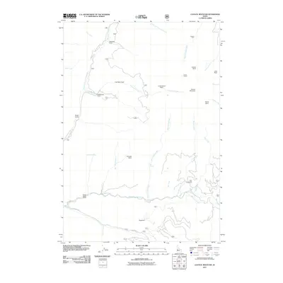
2011 Map of Council Mountain
USGS Topo · Published 2011About this map
Council Mountain stands as the geographic centerpiece of this high-elevation terrain, where a network of gulches and basins reveals a history of resource extraction and seasonal habitation. The presence of the Mica Mine near the eastern edge and the naming of Log Cabin Gulch and Cookhouse Gulch suggest a landscape shaped by mining operations and the camps that supported them. High points like the Council Lookout provided essential oversight of these wooded drainages.
Find a feature on this map
40 named features on this map. Tap any name to fly to it.
Don’t see what you’re looking for? This feature index may not catch every label — zoom into the map to look around manually.
Map Details
Editions of this 2011 Council Mountain Map
This is the sole edition of this map. No revisions or reprints were ever made.
Other maps of this area

1911 · Meadows
USGS Topo · 1:125,000

1954 · Council
USGS Topo · 1:62,500

1954 · New Meadows
USGS Topo · 1:62,500

1954 · Cascade
USGS Topo · 1:62,500

1955 · Baker
USGS Topo · 1:250,000

1959 · Baker
USGS Topo · 1:250,000
1973 · No Business Mtn
USGS Topo · 1:24,000

1980 · McCall
USGS Topo · 1:100,000
1985 · Cold Spring Ridge
USGS Topo · 1:24,000
1985 · Lone Tree
USGS Topo · 1:24,000