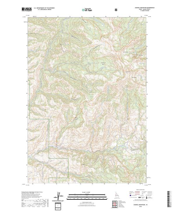
2024 Map of Council Mountain
USGS Topo · Published 2024About this map
Payette National Forest dominates this section of the Idaho backcountry, centered on the high elevations of Council Mtn. This topographic study reveals a landscape defined by dramatic glacial features, including a series of high-altitude basins such as Granite Basin, Cottonwood Basin, and Lake Basin. The complex drainage network is anchored by the Middle Fork Weiser River and the East Fork Weiser River, which carve through deep canyons like Grossen Canyon and Dutch Oven Gulch. The presence of Hot Spring near the river forks suggests the geothermal activity common to this region's geological profile. Access to this remote terrain is marked by a network of forest development roads and primitive trails, including the Council Mountain Trl and Granite Creek Trl, which connect the various basins and summits like Sugarloaf. The map provides a clear picture of the land as managed for recreation and resource conservation in the early 21st century.
Find a feature on this map
47 named features on this map. Tap any name to fly to it.
Don’t see what you’re looking for? This feature index may not catch every label — zoom into the map to look around manually.
Map Details
Editions of this 2024 Council Mountain Map
This is the sole edition of this map. No revisions or reprints were ever made.
Other maps of this area

1911 · Meadows
USGS Topo · 1:125,000

1954 · Council
USGS Topo · 1:62,500

1954 · New Meadows
USGS Topo · 1:62,500

1954 · Cascade
USGS Topo · 1:62,500

1955 · Baker
USGS Topo · 1:250,000

1959 · Baker
USGS Topo · 1:250,000
1973 · No Business Mtn
USGS Topo · 1:24,000

1980 · McCall
USGS Topo · 1:100,000
1985 · Cold Spring Ridge
USGS Topo · 1:24,000
1985 · Lone Tree
USGS Topo · 1:24,000