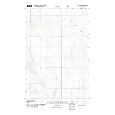
2011 Map of Courtenay NW
USGS Topo · Published 2011About this map
Saint James Cemetery and Zion Cemetery stand as quiet landmarks within this rural section of Stutsman County, offering valuable reference points for those researching the early families of the region. The landscape is defined by the prairie potholes and drainage patterns of the Missouri Coteau, where Stony Brook meanders through the northern section and Rudolph Lake occupies a low-lying basin to the south. This 2011 survey by the U.S. Geological Survey illustrates a sparsely populated agricultural area, where the section-line road network, including 12th St SE and 19th St SE, maintains a rigid grid over the undulating glacial terrain. The absence of concentrated town sites emphasizes the isolated, agrarian nature of this landscape during the early 21st century.
Find a feature on this map
10 named features on this map. Tap any name to fly to it.
Don’t see what you’re looking for? This feature index may not catch every label — zoom into the map to look around manually.
Map Details
Editions of this 2011 Courtenay NW Map
This is the sole edition of this map. No revisions or reprints were ever made.
Other maps of this area

1900 · Pingree
USGS Topo · 1:125,000

1900 · Pingree
USGS Topo · 1:62,500

1950 · Buchanan
USGS Topo · 1:24,000

1950 · Fried
USGS Topo · 1:24,000

1951 · Fried
USGS Topo · 1:24,000

1951 · Arrowwood Lake
USGS Topo · 1:24,000

1951 · Spiritwood Lake
USGS Topo · 1:24,000

1951 · Kensal
USGS Topo · 1:24,000

1951 · Courtenay
USGS Topo · 1:24,000

1951 · Kensal SE
USGS Topo · 1:24,000