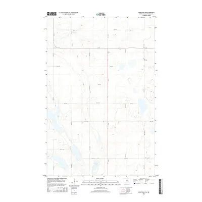
2014 Map of Courtenay NW
USGS Topo · Published 2014About this map
Saint James Cem and Zion Cem anchor the rural landscape of Stutsman County in this topographic study, reflecting the generational heritage of this agricultural region. The terrain is defined by a dense network of sectional roads, including 84th Ave SE and 17th St SE, which grid the prairies between scattered water bodies. In the southern portion of the quadrangle, Rudolph Lake provides a significant landmark amidst the undulating contours, while Stony Brook meanders through the northern section. This map documents a high-plains environment where state infrastructure like ND-20 and Hy 9 SE intersects with a long-established pattern of local farm-to-market roads, maintaining the geographic layout typical of North Dakota's central plains well into the 21st century.
Find a feature on this map
20 named features on this map. Tap any name to fly to it.
Don’t see what you’re looking for? This feature index may not catch every label — zoom into the map to look around manually.
Map Details
Editions of this 2014 Courtenay NW Map
This is the sole edition of this map. No revisions or reprints were ever made.
Other maps of this area

1900 · Pingree
USGS Topo · 1:125,000

1900 · Pingree
USGS Topo · 1:62,500

1950 · Buchanan
USGS Topo · 1:24,000

1950 · Fried
USGS Topo · 1:24,000

1951 · Fried
USGS Topo · 1:24,000

1951 · Arrowwood Lake
USGS Topo · 1:24,000

1951 · Spiritwood Lake
USGS Topo · 1:24,000

1951 · Kensal
USGS Topo · 1:24,000

1951 · Courtenay
USGS Topo · 1:24,000

1951 · Kensal SE
USGS Topo · 1:24,000