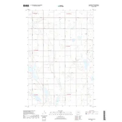
2018 Map of Courtenay NW
USGS Topo · Published 2018About this map
Stony Brook meanders through the northern reaches of this North Dakota landscape, cutting through a terrain marked by numerous prairie potholes and seasonal wetlands. The map reveals the strictly organized grid of Stutsman County, where section lines are traced by a network of rural roads such as 12th St SE and 83rd Ave SE. This late-era survey documents the enduring agricultural layout of the region, anchored by historical landmarks that serve the local community. These include Saint James Cem in the northeast and Zion Cem in the southeast, both providing vital touchpoints for genealogical research. The presence of Rudolph Lake in the southern portion of the quadrangle highlights the importance of surface water in this expansive prairie environment, while the township and range boundaries, such as T143n R63w, clarify the legal divisions of the land.
Find a feature on this map
25 named features on this map. Tap any name to fly to it.
Don’t see what you’re looking for? This feature index may not catch every label — zoom into the map to look around manually.
Map Details
Editions of this 2018 Courtenay NW Map
This is the sole edition of this map. No revisions or reprints were ever made.
Other maps of this area

1900 · Pingree
USGS Topo · 1:125,000

1900 · Pingree
USGS Topo · 1:62,500

1950 · Buchanan
USGS Topo · 1:24,000

1950 · Fried
USGS Topo · 1:24,000

1951 · Fried
USGS Topo · 1:24,000

1951 · Arrowwood Lake
USGS Topo · 1:24,000

1951 · Spiritwood Lake
USGS Topo · 1:24,000

1951 · Kensal
USGS Topo · 1:24,000

1951 · Courtenay
USGS Topo · 1:24,000

1951 · Kensal SE
USGS Topo · 1:24,000