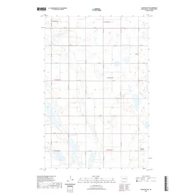
2020 Map of Courtenay NW
USGS Topo · Published 2020About this map
Stony Brook meanders through the northern plains of this agricultural corridor in Stutsman County, carving a path through a landscape dotted with numerous wetlands and prairie potholes. This 2020 survey reveals a highly organized township-and-range grid, where the transition of seasons is marked by the cultivation of the surrounding fields. Local history and genealogy are anchored by two significant landmarks: the Saint Marys Cem in the northeast and the German Zion Evangelical Lutheran Cem in the southeast. These sites serve as quiet reminders of the early communities and congregations that established roots in this part of North Dakota. The area's connectivity is maintained through a system of rural routes, including Co Rd 43 and a series of numbered roads like 12th St SE and 19th St SE, which facilitate the movement of equipment and people across this productive terrain.
Find a feature on this map
21 named features on this map. Tap any name to fly to it.
Don’t see what you’re looking for? This feature index may not catch every label — zoom into the map to look around manually.
Map Details
Editions of this 2020 Courtenay NW Map
This is the sole edition of this map. No revisions or reprints were ever made.
Other maps of this area

1900 · Pingree
USGS Topo · 1:125,000

1900 · Pingree
USGS Topo · 1:62,500

1950 · Buchanan
USGS Topo · 1:24,000

1950 · Fried
USGS Topo · 1:24,000

1951 · Fried
USGS Topo · 1:24,000

1951 · Arrowwood Lake
USGS Topo · 1:24,000

1951 · Spiritwood Lake
USGS Topo · 1:24,000

1951 · Kensal
USGS Topo · 1:24,000

1951 · Courtenay
USGS Topo · 1:24,000

1951 · Kensal SE
USGS Topo · 1:24,000