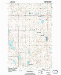
1990 Map of Courtenay NW
USGS Topo · Published 1995About this map
Jim River Valley topography defines this portion of Stutsman County, where the landscape is dotted with numerous small wetlands and protected conservation lands. Much of the terrain is dedicated to the National Waterfowl Production Area, reflecting the region's importance within the prairie pothole ecosystem. Significant local landmarks include Rudolph Lake and several smaller unnamed water bodies scattered throughout the townships of Kensal, Nogosek, Lyon, Durham, and Ashland. For genealogists and local historians, the presence of St James Cem in the northeast and Zion Cem in the southeast provides specific points of interest for family research. This survey, updated with 1990 imagery, maintains the 1940s-era topographic foundations, illustrating the enduring agricultural and natural character of the North Dakota plains.
Find a feature on this map
10 named features on this map. Tap any name to fly to it.
Don’t see what you’re looking for? This feature index may not catch every label — zoom into the map to look around manually.
Map Details
Editions of this 1990 Courtenay NW Map
This is the sole edition of this map. No revisions or reprints were ever made.
Other maps of this area

1900 · Pingree
USGS Topo · 1:125,000

1900 · Pingree
USGS Topo · 1:62,500

1950 · Buchanan
USGS Topo · 1:24,000

1950 · Fried
USGS Topo · 1:24,000

1951 · Fried
USGS Topo · 1:24,000

1951 · Arrowwood Lake
USGS Topo · 1:24,000

1951 · Spiritwood Lake
USGS Topo · 1:24,000

1951 · Kensal
USGS Topo · 1:24,000

1951 · Courtenay
USGS Topo · 1:24,000

1951 · Kensal SE
USGS Topo · 1:24,000