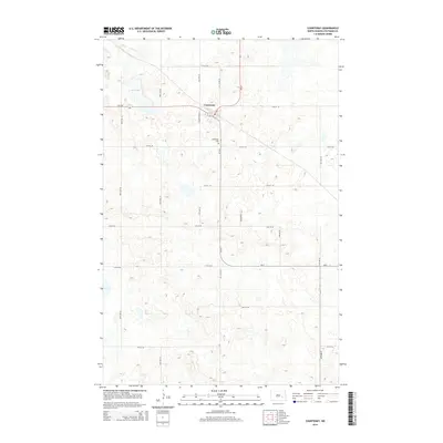
2014 Map of Courtenay
USGS Topo · Published 2014About this map
Courtenay serves as the central hub of this eastern Stutsman County landscape, situated at the intersection of several regional routes including Hy 9 SE and ND-20. The town's grid is small and orderly, giving way to an expansive prairie landscape defined by a rectilinear system of section roads like 91st Ave SE and 14th St SE. Just south of the settlement, the Courtenay Cem sits along 91 1/2 Ave SE, providing a primary point of interest for genealogists tracing local families. To the northwest, Fox Lake introduces one of the few natural water features in this high-plains terrain. The map's contour lines illustrate the subtle glacial topography of the region, where numerous small depressions and low rises dictate the local drainage patterns and the placement of early 20th-century farmsteads.
Find a feature on this map
22 named features on this map. Tap any name to fly to it.
Don’t see what you’re looking for? This feature index may not catch every label — zoom into the map to look around manually.
Map Details
Editions of this 2014 Courtenay Map
This is the sole edition of this map. No revisions or reprints were ever made.
Other maps of this area

1900 · Pingree
USGS Topo · 1:125,000

1950 · Fried
USGS Topo · 1:24,000

1951 · Fried
USGS Topo · 1:24,000

1951 · Spiritwood Lake
USGS Topo · 1:24,000

1951 · Kensal
USGS Topo · 1:24,000

1951 · Courtenay
USGS Topo · 1:24,000

1951 · Kensal SE
USGS Topo · 1:24,000

1952 · Courtenay NW
USGS Topo · 1:24,000

1952 · New Rockford
USGS Topo · 1:250,000

1956 · New Rockford
USGS Topo · 1:250,000