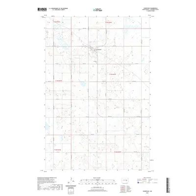
2020 Map of Courtenay
USGS Topo · Published 2020About this map
Courtenay serves as the central hub of this prairie landscape in Stutsman County, where the grid of the North Dakota plains is defined by a rigorous network of section lines and county roads. The town is situated along Railway Ave W, reflecting its origins as a rail-oriented settlement. The landscape is dotted with numerous small wetlands and prairie potholes, with Fox Lake standing out as a larger water body in the northwest corner. A short distance south of the main residential grid lies the Courtenay Cem, a significant site for genealogical research in this rural township. The transition between township boundaries, such as t144n r62w and t143n r62w, is clearly demarcated by a systematic road network including Co Hwy 63, which provides a primary north-south corridor through the central plains.
Find a feature on this map
26 named features on this map. Tap any name to fly to it.
Don’t see what you’re looking for? This feature index may not catch every label — zoom into the map to look around manually.
Map Details
Editions of this 2020 Courtenay Map
This is the sole edition of this map. No revisions or reprints were ever made.
Other maps of this area

1900 · Pingree
USGS Topo · 1:125,000

1950 · Fried
USGS Topo · 1:24,000

1951 · Fried
USGS Topo · 1:24,000

1951 · Spiritwood Lake
USGS Topo · 1:24,000

1951 · Kensal
USGS Topo · 1:24,000

1951 · Courtenay
USGS Topo · 1:24,000

1951 · Kensal SE
USGS Topo · 1:24,000

1952 · Courtenay NW
USGS Topo · 1:24,000

1952 · New Rockford
USGS Topo · 1:250,000

1956 · New Rockford
USGS Topo · 1:250,000