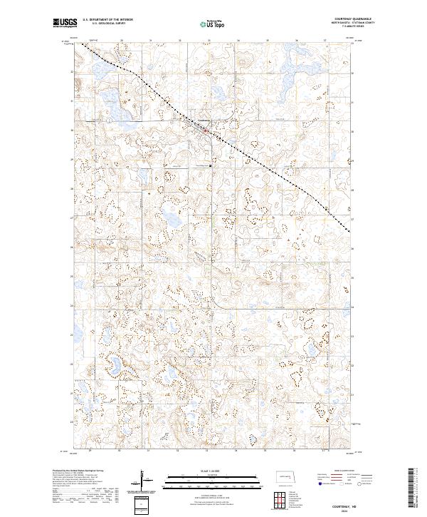
2024 Map of Courtenay
USGS Topo · Published 2024About this map
Courtenay sits at the heart of this prairie landscape, defined by a rigid section-line road grid and the seasonal character of its wetlands. The town's layout follows the diagonal path of Railway Ave W, a remnant of the transportation corridors that originally anchored North Dakota's agricultural settlements. To the south of the village, the Courtenay Cem serves as a primary point of interest for genealogists tracing the legacy of early families in the region.
Find a feature on this map
27 named features on this map. Tap any name to fly to it.
Don’t see what you’re looking for? This feature index may not catch every label — zoom into the map to look around manually.
Map Details
Editions of this 2024 Courtenay Map
This is the sole edition of this map. No revisions or reprints were ever made.
Other maps of this area

1900 · Pingree
USGS Topo · 1:125,000

1950 · Fried
USGS Topo · 1:24,000

1951 · Fried
USGS Topo · 1:24,000

1951 · Spiritwood Lake
USGS Topo · 1:24,000

1951 · Kensal
USGS Topo · 1:24,000

1951 · Courtenay
USGS Topo · 1:24,000

1951 · Kensal SE
USGS Topo · 1:24,000

1952 · Courtenay NW
USGS Topo · 1:24,000

1952 · New Rockford
USGS Topo · 1:250,000

1956 · New Rockford
USGS Topo · 1:250,000