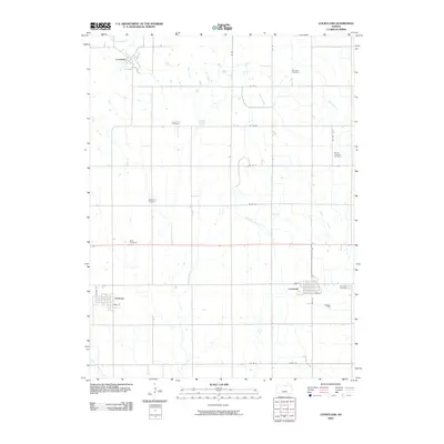
2009 Map of Courtland
USGS Topo · Published 2009About this map
Courtland and its surrounding Republic County agricultural lands are defined by a grid of rural roads and an extensive network of cemeteries that speak to the long-established farming communities of north-central Kansas. This survey captures the town layouts of Formoso and Lovewell, the latter situated near the winding course of White Rock Creek in the north. The landscape is marked by the Courtland West Canal, an essential irrigation feature that cuts diagonally across the township toward the southeast. Genealogists will find significant value in the distribution of burial grounds across the section lines, including Persinger Cemetery, Laurel Hill Cemetery, Mount Pleasant Cemetery, and Saint Paul Cemetery. These sites, along with Balch Cemetery, provide a clear spatial record of the family settlements that have anchored this region since its early development. The drainage patterns of Beaver Creek and Mud Creek further illustrate the topographic challenges faced by early settlers in this high plains environment.
Find a feature on this map
28 named features on this map. Tap any name to fly to it.
Don’t see what you’re looking for? This feature index may not catch every label — zoom into the map to look around manually.
Map Details
Editions of this 2009 Courtland Map
This is the sole edition of this map. No revisions or reprints were ever made.
Other maps of this area

1892 · Concordia
USGS Topo · 1:125,000

1894 · Mankato
USGS Topo · 1:125,000

1955 · Manhattan
USGS Topo · 1:250,000

1955 · Beloit
USGS Topo · 1:250,000

1956 · Manhattan
USGS Topo · 1:250,000

1957 · Manhattan
USGS Topo · 1:250,000

1959 · Beloit
USGS Topo · 1:250,000

1965 · Kackley
USGS Topo · 1:24,000

1966 · Scandia
USGS Topo · 1:24,000
1968 · Jamestown NW
USGS Topo · 1:24,000