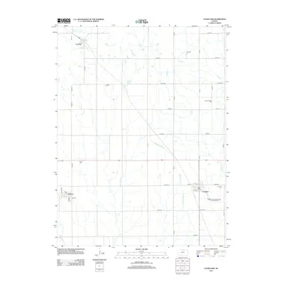
2012 Map of Courtland
USGS Topo · Published 2012About this map
Courtland and Formoso anchor the southeastern and southwestern corners of this agricultural landscape in Republic County. The terrain is defined by the managed flow of the Courtland West Canal, which cuts across the prairie to support local farming. To the north, the small settlement of Lovewell sits near the banks of White Rock Cr, while the winding courses of Beaver Cr and Mud Cr drain the central and eastern sections of the quadrangle.
Find a feature on this map
36 named features on this map. Tap any name to fly to it.
Don’t see what you’re looking for? This feature index may not catch every label — zoom into the map to look around manually.
Map Details
Editions of this 2012 Courtland Map
This is the sole edition of this map. No revisions or reprints were ever made.
Other maps of this area

1892 · Concordia
USGS Topo · 1:125,000

1894 · Mankato
USGS Topo · 1:125,000

1955 · Manhattan
USGS Topo · 1:250,000

1955 · Beloit
USGS Topo · 1:250,000

1956 · Manhattan
USGS Topo · 1:250,000

1957 · Manhattan
USGS Topo · 1:250,000

1959 · Beloit
USGS Topo · 1:250,000

1965 · Kackley
USGS Topo · 1:24,000

1966 · Scandia
USGS Topo · 1:24,000
1968 · Jamestown NW
USGS Topo · 1:24,000