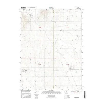
2015 Map of Courtland
USGS Topo · Published 2015About this map
Courtland and Formoso anchor this portion of the northern Kansas plains, where the border of Jewell Co and Republic Co divides a landscape of agricultural tradition and rural infrastructure. The mapping reveals a detailed network of section-line roads, including Main Lovewell and Rock Rd, which connect the small settlements and homesteads to the area's essential water management features. Central to the local economy is the Courtland W Canal, which works alongside natural drainages like White Rock Cr and Beaver Cr to support the surrounding farmland.
Find a feature on this map
43 named features on this map. Tap any name to fly to it.
Don’t see what you’re looking for? This feature index may not catch every label — zoom into the map to look around manually.
Map Details
Editions of this 2015 Courtland Map
This is the sole edition of this map. No revisions or reprints were ever made.
Other maps of this area

1892 · Concordia
USGS Topo · 1:125,000

1894 · Mankato
USGS Topo · 1:125,000

1955 · Manhattan
USGS Topo · 1:250,000

1955 · Beloit
USGS Topo · 1:250,000

1956 · Manhattan
USGS Topo · 1:250,000

1957 · Manhattan
USGS Topo · 1:250,000

1959 · Beloit
USGS Topo · 1:250,000

1965 · Kackley
USGS Topo · 1:24,000

1966 · Scandia
USGS Topo · 1:24,000
1968 · Jamestown NW
USGS Topo · 1:24,000