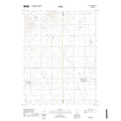
2018 Map of Courtland
USGS Topo · Published 2018About this map
Courtland and Formoso anchor this agricultural landscape in Republic County, where the transition between the rolling uplands and the river valleys is clearly marked by a systematic grid of section roads. The central feature of the local irrigation infrastructure is the Courtland W Canal, which cuts diagonally across the townships of t2s r5w and t3s r5w. This 2018 survey provides a precise record of the rural landscape, including a high density of historical burial grounds that serve as touchstones for local family history, such as the Persinger Cem and Mount Pleasant Cem.
Find a feature on this map
47 named features on this map. Tap any name to fly to it.
Don’t see what you’re looking for? This feature index may not catch every label — zoom into the map to look around manually.
Map Details
Editions of this 2018 Courtland Map
This is the sole edition of this map. No revisions or reprints were ever made.
Other maps of this area

1892 · Concordia
USGS Topo · 1:125,000

1894 · Mankato
USGS Topo · 1:125,000

1955 · Manhattan
USGS Topo · 1:250,000

1955 · Beloit
USGS Topo · 1:250,000

1956 · Manhattan
USGS Topo · 1:250,000

1957 · Manhattan
USGS Topo · 1:250,000

1959 · Beloit
USGS Topo · 1:250,000

1965 · Kackley
USGS Topo · 1:24,000

1966 · Scandia
USGS Topo · 1:24,000
1968 · Jamestown NW
USGS Topo · 1:24,000