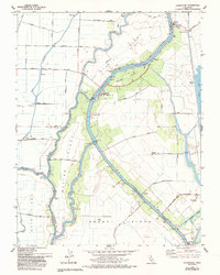
1978 Map of Courtland
USGS Topo · Published 1993About this map
Merritt Island and Grand Island dominate this intricate look at the Sacramento River Delta, where the landscape is defined by a complex network of levees and waterways. The map illustrates the early 1970s character of small riverfront communities like Courtland and Locke, both significant for their historic architecture and role in the regional agricultural economy. Water management is central to the area's layout, with labels for numerous Pumping Stations, a Tide Gage, and the winding paths of Steamboat Slough and Sutter Slough.
Find a feature on this map
45 named features on this map. Tap any name to fly to it.
Don’t see what you’re looking for? This feature index may not catch every label — zoom into the map to look around manually.
Map Details
Editions of this 1978 Courtland Map
3 editions found

Other maps of this area

1894 · Lodi
USGS Topo · 1:125,000

1908 · Courtland
USGS Topo · 1:62,500

1909 · Florin
USGS Topo · 1:31,680

1910 · New Hope
USGS Topo · 1:31,680

1910 · Rio Vista
USGS Topo · 1:31,680

1910 · Bruceville
USGS Topo · 1:31,680

1910 · Isleton
USGS Topo · 1:31,680

1916 · Cache Slough
USGS Topo · 1:31,680

1916 · Vorden
USGS Topo · 1:31,680
1916 · Babel Slough
USGS Topo · 1:31,680