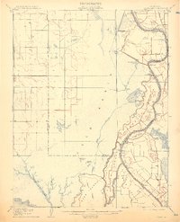
1908 Map of Courtland
USGS Topo · Published 1914About this map
The Sacramento River anchors this early 20th-century survey, defining a complex network of levees, islands, and sloughs that supported the region's burgeoning agricultural economy. Large tracts of land are reclaimed as islands, including Merritt Island, Sutter Island, and Grand Island, separated by channels like Steamboat Slough and Miner Slough. The landscape is dominated by the vast Yolo Basin to the west and the intricate water management infrastructure of the era, such as the Sacramento Drainage Canal and the Clamshell Cut. Small riverfront settlements such as Courtland, Clarksburg, and Freeport appear as vital transit points, while a Pumping Plant and a Drawbridge near Paintersville highlight the engineering required to inhabit this flood-prone delta. Archeological interest is noted by the presence of an Indian Mound near Big Lake, pointing to a much longer history of human occupation along these waterways.
Find a feature on this map
37 named features on this map. Tap any name to fly to it.
Don’t see what you’re looking for? This feature index may not catch every label — zoom into the map to look around manually.
Map Details
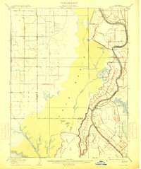
Editions of this 1908 Courtland Map
3 editions found
Other maps of this area

1891 · Sacramento
USGS Topo · 1:125,000

1892 · Sacramento
USGS Topo · 1:125,000

1893 · Sacramento
USGS Topo · 1:125,000

1894 · Lodi
USGS Topo · 1:125,000

1902 · Fairoaks
USGS Topo · 1:62,500

1907 · Woodland
USGS Topo · 1:62,500

1907 · Davisville
USGS Topo · 1:62,500

1907 · Antioch
USGS Topo · 1:62,500

1908 · Vacaville
USGS Topo · 1:62,500

1908 · Courtland
USGS Topo · 1:62,500