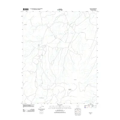
2011 Map of Cove
USGS Topo · Published 2011About this map
Cove and the settlement of Yazzi occupy a high-desert landscape defined by the intersection of mountain ranges and seasonal watercourses. Situated in the shadow of the Chuska Mountains and the Lukachukai Mountains, this area is crisscrossed by a network of local routes including Indian Rte-33 and Indian Rte-334. The topography is marked by significant landmarks like the Royal Arch and several critical water sources such as Cottonwood Spring and Pine Water Spring, which highlight the importance of localized hydrology in this arid region. The drainage patterns of Cove Wash and Standing Redrock Creek further illustrate the natural corridors that have influenced movement and settlement. A designated View Point overlooks the rugged transition between the mountain foothills and the wash basins, providing a spatial perspective on this part of the Shiprock Agency territory.
Find a feature on this map
14 named features on this map. Tap any name to fly to it.
Don’t see what you’re looking for? This feature index may not catch every label — zoom into the map to look around manually.
Map Details
Editions of this 2011 Cove Map
This is the sole edition of this map. No revisions or reprints were ever made.
Other maps of this area

1892 · Canyon De Chelly
USGS Topo · 1:250,000

1953 · Los Gigantes NE
USGS Topo · 1:24,000

1953 · Redrock Valley NE
USGS Topo · 1:24,000

1953 · Redrock Valley SE
USGS Topo · 1:24,000

1953 · Redrock Valley SW
USGS Topo · 1:24,000

1953 · Los Gigantes SE
USGS Topo · 1:24,000

1953 · Redrock Valley NW
USGS Topo · 1:24,000

1953 · Los Gigantes Buttes
USGS Topo · 1:62,500

1953 · Redrock Valley
USGS Topo · 1:62,500

1954 · Shiprock
USGS Topo · 1:250,000