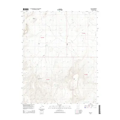
2014 Map of Cove
USGS Topo · Published 2014About this map
Cove lies at the transition between the high, structured peaks of the Chuska Mountains and the lower basin topography of northeastern Arizona. This 2014 survey captures a landscape defined by seasonal water drainage and traditional Navajo Nation settlement patterns, including Yazzi and Red Rock Valley. The map detail follows the path of Cove Wash as it flows eastward through the valley floor, while higher elevations to the south reach into the Lukachukai Mountains. Topographic features like the Royal Arch and View Point illustrate the geological complexity of the area, providing clear landmarks for navigation. Local water resources are identified through sites like Cottonwood Spring and Pine Water Spring, which have historically supported livestock and community life in this arid environment. Bureau of Indian Affairs routes such as Bia-33 and Bia-332 provide the primary infrastructure connecting these remote ranching and residential areas.
Find a feature on this map
21 named features on this map. Tap any name to fly to it.
Don’t see what you’re looking for? This feature index may not catch every label — zoom into the map to look around manually.
Map Details
Editions of this 2014 Cove Map
This is the sole edition of this map. No revisions or reprints were ever made.
Other maps of this area

1892 · Canyon De Chelly
USGS Topo · 1:250,000

1953 · Los Gigantes NE
USGS Topo · 1:24,000

1953 · Redrock Valley NE
USGS Topo · 1:24,000

1953 · Redrock Valley SE
USGS Topo · 1:24,000

1953 · Redrock Valley SW
USGS Topo · 1:24,000

1953 · Los Gigantes SE
USGS Topo · 1:24,000

1953 · Redrock Valley NW
USGS Topo · 1:24,000

1953 · Los Gigantes Buttes
USGS Topo · 1:62,500

1953 · Redrock Valley
USGS Topo · 1:62,500

1954 · Shiprock
USGS Topo · 1:250,000