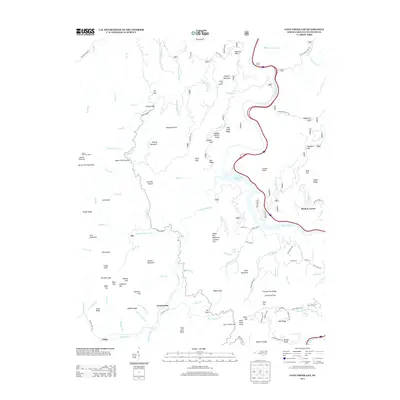
2013 Map of Cove Creek Gap
USGS Topo · Published 2013About this map
Shelton Laurel and the high ridge of Mount Sterling anchor this survey of the North Carolina high country. The landscape is defined by its verticality, rising from the Pigeon River and the reservoir of Waterville Lake to prominent peaks like Scottish Mount and Buzzard Roost. Small, high-altitude settlements such as Ola and Nellie are situated along the winding paths of Little Cataloochee Cr and Cataloochee Cr, showing the localized habitation patterns of the Haywood County mountains. The map details an extensive network of ridges and coves, including Wading Branch Ridge and Rathbone Cove, which once supported isolated homesteads and high-meadow agriculture. Former fire observation points at Mount Sterling Lookout and Sutton Top Lookout highlight the strategic importance of these summits for forest management within the surrounding wilderness areas.
Find a feature on this map
128 named features on this map. Tap any name to fly to it.
Don’t see what you’re looking for? This feature index may not catch every label — zoom into the map to look around manually.
Map Details
Editions of this 2013 Cove Creek Gap Map
This is the sole edition of this map. No revisions or reprints were ever made.
Other maps of this area

1893 · Mt Guyot
USGS Topo · 1:125,000

1894 · Asheville
USGS Topo · 1:125,000

1901 · Asheville
USGS Topo · 1:125,000

1912 · Mt Guyot
USGS Topo · 1:125,000

1935 · Newport
USGS Topo · 1:48,000

1935 · Hartford
USGS Topo · 1:24,000

1935 · Dellwood
USGS Topo · 1:24,000

1935 · Clyde
USGS Topo · 1:24,000

1935 · Lemon Gap
USGS Topo · 1:24,000

1936 · Bunches Bald
USGS Topo · 1:24,000