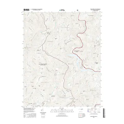
2016 Map of Cove Creek Gap
USGS Topo · Published 2016About this map
Cataloochee and the high ridges of Haywood County define this landscape, where the Great Smoky Mountains National Park meets the Pisgah National Forest. The map documents a territory marked by early mountain travel, specifically the route of the Old Cataloochee Turnpike. Several small settlements like Ola, Nellie, and Shelton Laurel are recorded alongside an extensive collection of family burial sites and rural landmarks. Genealogists will find particular value in the distribution of family-named cemeteries, including the O E Kerr African Cem, Lawson Jenkins - Kerr Cem, and Hannah Cem. Cultural sites such as Palmer Chapel and the Little Cataloochee Baptist Church reflect the deep-rooted community life of the region. The map also traces the Cataloochee Creek watershed as it flows beneath Mount Sterling Ridge and Longarm Mountain, providing a detailed look at the hydrology of the Smokies.
Find a feature on this map
124 named features on this map. Tap any name to fly to it.
Don’t see what you’re looking for? This feature index may not catch every label — zoom into the map to look around manually.
Map Details
Editions of this 2016 Cove Creek Gap Map
This is the sole edition of this map. No revisions or reprints were ever made.
Other maps of this area

1893 · Mt Guyot
USGS Topo · 1:125,000

1894 · Asheville
USGS Topo · 1:125,000

1901 · Asheville
USGS Topo · 1:125,000

1912 · Mt Guyot
USGS Topo · 1:125,000

1935 · Newport
USGS Topo · 1:48,000

1935 · Hartford
USGS Topo · 1:24,000

1935 · Dellwood
USGS Topo · 1:24,000

1935 · Clyde
USGS Topo · 1:24,000

1935 · Lemon Gap
USGS Topo · 1:24,000

1936 · Bunches Bald
USGS Topo · 1:24,000