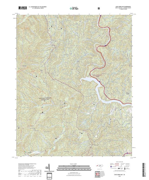
2022 Map of Cove Creek Gap
USGS Topo · Published 2022About this map
The divide between the Pisgah National Forest and the Great Smoky Mountains National Park defines this corner of Haywood County, where steep ridgelines like Hurricane Ridge and Coffee Ridge overlook deeply etched creek beds. The landscape is marked by its early 20th-century isolation, preserved through historical routes such as the Old Cataloochee Turnpike and the Little Cataloochee Trl. Small settlements like Nellie and Ola are situated near watercourses, while numerous family-named burial grounds, including the O E Kerr African Cem and McMahan's Grave, provide significant clues for genealogical research in this mountain region. The presence of the Little Cataloochee Baptist Church and Palmer Chapel suggests the importance of community centers in these secluded valleys. Elevation shifts are extreme, moving from the Pigeon River up to peaks like Buzzard Roost and Mount Sterling, illustrating the difficult terrain that historical residents negotiated daily.
Find a feature on this map
125 named features on this map. Tap any name to fly to it.
Don’t see what you’re looking for? This feature index may not catch every label — zoom into the map to look around manually.
Map Details
Editions of this 2022 Cove Creek Gap Map
This is the sole edition of this map. No revisions or reprints were ever made.
Other maps of this area

1893 · Mt Guyot
USGS Topo · 1:125,000

1894 · Asheville
USGS Topo · 1:125,000

1901 · Asheville
USGS Topo · 1:125,000

1912 · Mt Guyot
USGS Topo · 1:125,000

1935 · Newport
USGS Topo · 1:48,000

1935 · Hartford
USGS Topo · 1:24,000

1935 · Dellwood
USGS Topo · 1:24,000

1935 · Clyde
USGS Topo · 1:24,000

1935 · Lemon Gap
USGS Topo · 1:24,000

1936 · Bunches Bald
USGS Topo · 1:24,000