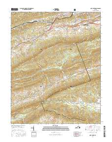
2016 Map of Cove Creek
USGS Topo · Published 2016About this map
The Bluestone River winds through this section of the Appalachian Highlands, where the residential expansion of Bluefield meets the steep, wooded ridges of the Jefferson National Forest. This landscape is defined by its deep valley structures, including Wrights Valley and Burkes Garden, separated by the towering heights of E River Mtn and Garden Mtn. Evidence of the area’s agricultural and industrial heritage is visible in the placement of water-dependent sites like Shawver Mill and Gose Mill, situated along the Clear Fork and Burkes Garden Creek. The transition from suburban development in the north to the managed wilderness of the south is marked by a network of local roads and the Trl Of The Lonesome Pine, which skirts the edge of Shannandale and Saint Clair. Genealogists may find interest in localized burial grounds such as Lukes Cem and the Valley Vista Cem, as well as the more modern Grandview Memory Gardens.
Find a feature on this map
93 named features on this map. Tap any name to fly to it.
Don’t see what you’re looking for? This feature index may not catch every label — zoom into the map to look around manually.
Map Details
Editions of this 2016 Cove Creek Map
This is the sole edition of this map. No revisions or reprints were ever made.
Other maps of this area

1887 · Pocahontas
USGS Topo · 1:125,000

1891 · Pocahontas
USGS Topo · 1:125,000

1894 · Pocahontas
USGS Topo · 1:125,000

1895 · Pocahontas
USGS Topo · 1:125,000

1909 · Pocahontas Special
USGS Topo · 1:48,000

1911 · Pocahontas Special
USGS Topo · 1:62,500

1913 · Bluefield
USGS Topo · 1:48,000

1916 · Bluefield
USGS Topo · 1:62,500

1924 · Bramwell
USGS Topo · 1:62,500

1924 · Bluefield
USGS Topo · 1:62,500